
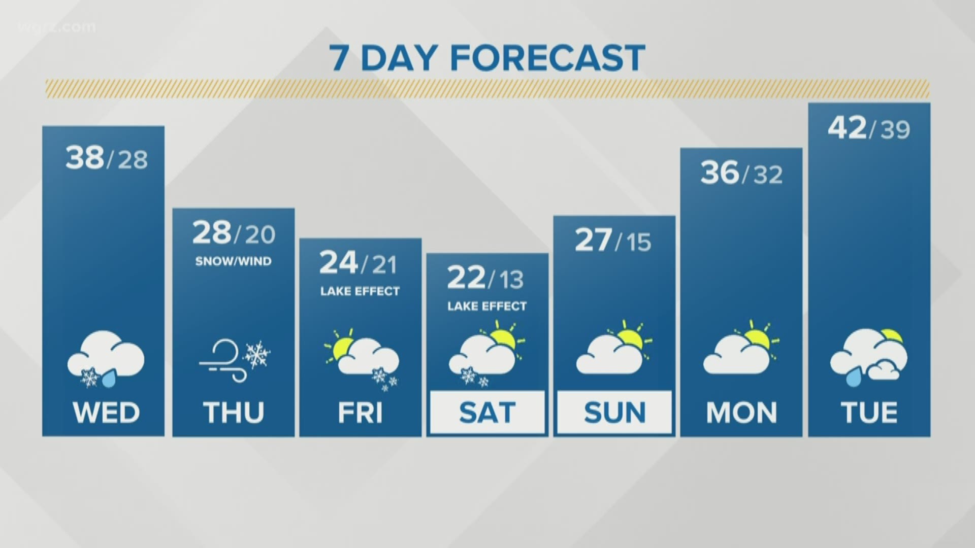
BUFFALO, N.Y. — Following one of the sunniest weekends Western New York will have seen this winter, two weather systems could bring either rain or snow each for the last full week of February.
The first weather system to watch will move into the region late Monday, bringing the chance for scattered showers that will be on and off through Tuesday.
Like many previous weather systems this winter, this first one will likely weaken as it tracks over the Great Lakes, minimizing the potential for any heavy precipitation or strong winds.
By Wednesday, a dip in the jet stream will provide enough energy to help a second system develop near Chicago. These two weather systems would then interact with one another and bring the next round of precipitation for the second half of the week.With this weather set up, it's more likely for there to be greater impacts such as heavier precipitation and stronger winds.
Therefore, strong winds and accumulating snow are possible Thursday with lake effect snow Friday, especially for the Southern Tier. If this cold air is met with a strong enough northwest flow, accumulating lake effect snow will set up Thursday and Friday. Right now it appears the heaviest lake effect snows will set up south of Buffalo, however the snow bands could drift to the north impacting the city...stay tuned.
Temperatures swing in the other direction Friday through Sunday and will only max out in the 20s.
Keep tabs on the unsettled weather by checking back with Storm Team 2's latest forecast online and by using the WGRZ app on your mobile device.
RELATED: Storm Team 2 Weather Forecast