In the latest Spring Flood Outlook from the National Weather Service Northeast River Forecast Center, Western New York can expect near normal flood threats over the next two weeks.
Released Thursday, this update comes a day after NOAA announced changes to the way consumers will receive flash flood alerts. More information on those changes can be found here.
At the beginning of each New Year, flood forecasts are updated every two weeks to account for changes in snowpack and potential precipitation. These forecasts continue through May 1 with more attention brought to them before the start of Meteorological Spring: March 1st.

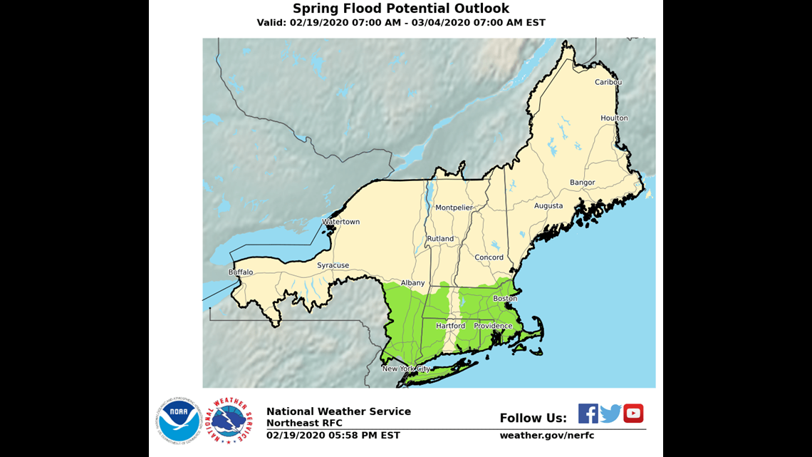
In the latest update, there is no change in the flood potential for WNY through March 4. As with every spring, this means that there is the potential for river flooding and ice jams as snow begins to melt as precipitation begins to make the seasonal switch to rain.
However, there's not much cause for concern at this point. Kirk Apffel, the Hydrology Project Manager at the National Weather Service in Buffalo, mentioned that the most common type of flooding WNY could experience this spring is river flooding. River flooding occurs when springtime rainfall and snow melt combine to cause a steady, more predictable rise in water levels.
RELATED: Storm Team 2 Weather Forecast