
BUFFALO, N.Y. — Snow today will be mainly focused in the Southern Tier, but a cold breeze will be a factor everywhere. Expect gusts around 30 mph on Friday.
Winds will be from the northwest. That means the most persistent snow bands will likely stay in the Southern Tier and some of the Southtowns, nearly the same area that took the brunt of the snow throughout this week. A couple of quick squalls may pass through the Niagara Frontier, but these will be limited.
Additional accumulation over the next 24 hours will be minimal, but roads may still be slick Friday night through early Saturday morning. Expect an additional inch or two in the higher elevations of the Southern Tier and a coating from time to time in Buffalo and the surrounding communities.
A few weak lake snow showers will hang on for Saturday morning and then fizzle out in the early afternoon.
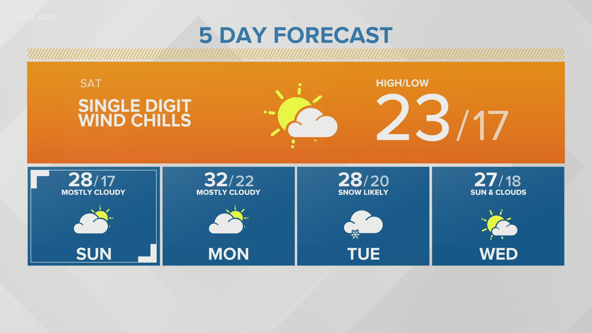
Wind and snow will take a break for the weekend, but both Saturday and Sunday will be cold with highs in the low to mid 20s.