
Snow showers will continue off and on around the Buffalo metro area through about 8 p.m. with no accumulation expected. A northwest breeze will continue to fuel lake effect showers in the Southtowns and Southern Tier through early Saturday morning. Snow should stop for everyone by 5 a.m. with sunshine quickly returning Saturday morning.
Total accumulations up to 4 inches are possible in the highest elevations of the Chautauqua Ridge and Boston Hills. Accumulation is unlikely for communities along the Lake Erie shoreline.
Plowable snowfall amounts are more likely east of Rochester and into upstate New York, which is closer to the center of the storm that sparked the snow showers in the first place.
Anyone traveling through the Southern Tier Friday night should be ready for a few slick spots. Once the sun sets, snow may accumulated a bit on roads and sidewalks in that region. You can view the Storm Team 2 radar here.
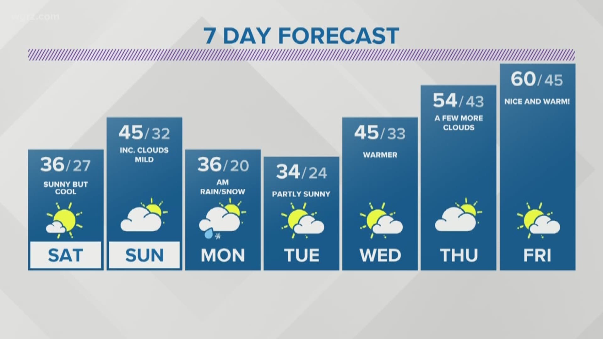
Saturday will be breezy early, but returning sunshine for the afternoon will melt the snow in a hurry. High temperatures will reach the mid 30s Saturday. Expect a partly sunny sky on Sunday with highs in the mid 40s.