
It isn't unusual to get snow in Western New York in November. Nor is it odd to get temperatures in the 20s and 30s.
What is a little different about this week's weather pattern is the combination of factors that are coming together to produce widespread snow rather than lake effect snow this early in the season.
For example, last year the third week of November was quite cold, but there wasn't much snowfall. Back in 2014, the third week of November brought cold and incredible amounts of snow to parts of the metro area but that was lake effect, not a widespread storm. The October surprise? Same thing. It was cold, there was snow, but it was a unique lake effect setup, not a widespread storm.
Monday's temperatures in the north central U.S. give an indication of how cold it could be here over the next couple of days. The afternoon temperature in Sturgeon Bay, WI was 21 degrees. The daily record low, which usually happens in the morning, was 23 degrees.
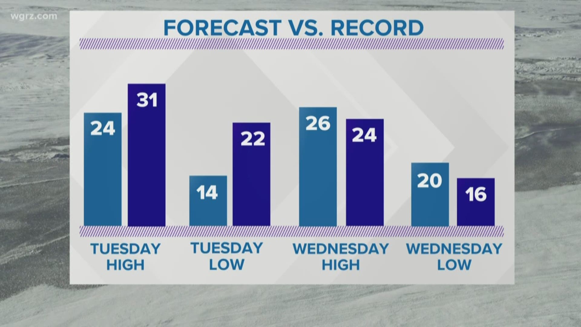
The forecast for Buffalo currently calls for a high of 24 degrees on Tuesday and 26 degrees on Wednesday. The coldest high temperatures on record for those days are 31 degrees (in 1983) and 24 degrees (in 1911) respectively. Record lows are 21 degrees (in 1921) and 16 degrees (in 1986).
Wind chills will also be a factor over the next couple of days. North-northwest winds will be sustained at 10 to 15 mph with a few gusts to 25 mph. That will keep wind chill values in the single digits day and night on Tuesday and Wednesday. Anyone needing to spend extended time outside should, as always, dress appropriately.
RELATED: Storm Team 2 Weather Forecast