
BUFFALO, N.Y. — This winter season had it all.
We started with a rather cold and snowy November, especially across the Southern Tier where 60 to 70” snow totals were common. Conditions turned decidedly quieter with a rather warm and uneventful December. Of course, all of that changed in the new year.
January 2019 turned out to be one of the snowiest January's on record. Over 63” of snow and 40” of that came in one week. We had a few hefty lake effect events and of course the notorious blizzard to end the month.
February began with a rise in temperatures. But that didn't last long as we saw an ice storm, a historic wind storm, and even more snow in the weeks that followed.
March started off quite cold and has seen numerous light snow events.
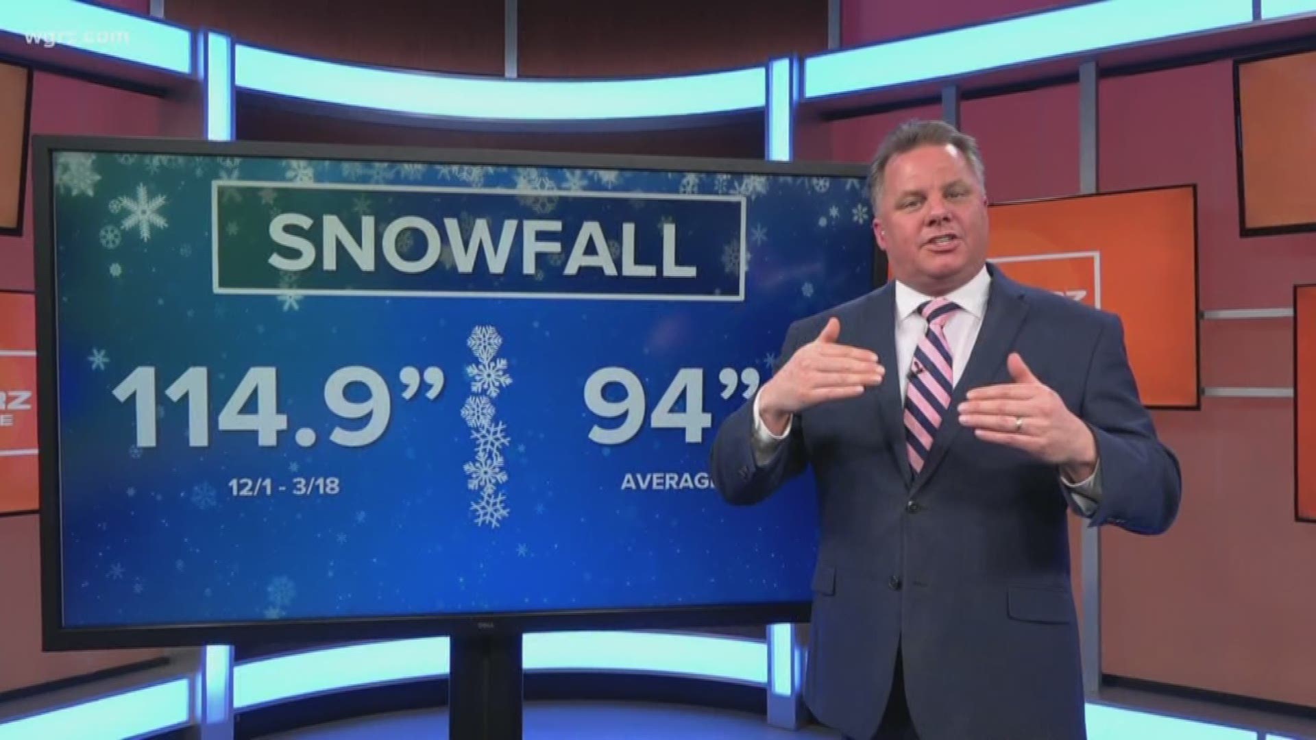
The Numbers
Our seasonal snowfall so far stands at 114.9". That is about 20” above normal for the entire season and more than what we were predicting when we gave our winter forecast.
In terms of temperatures, this winter is running at -1.4° below normal with the warmer months of December and February getting canceled out by the cold months of January and March.
It has also been a very windy season with 21 days registering wind gusts over 40 miles an hour. That is about 24% of the 90 days starting December 1.
As it goes in Buffalo, there is always the opportunity for spring snowfall, however, temperatures in the coming weeks do promise relief. Wednesday marks the first day of the new season and hopefully some renewed energy throughout Western New York.