BUFFALO, N.Y. — It's official: a La Niña is here!
In a recent statement from NOAA's Climate Prediction Center, forecasters confirmed that La Niña conditions did indeed develop within the past month and have a 87 percent chance of continuing throughout this upcoming winter from December of 2021 though February of 2022.
This is as expected and predicted since the last seasonal update was released mid-September. This comes too with the mention that La Niña conditions significantly strengthened within the past month.
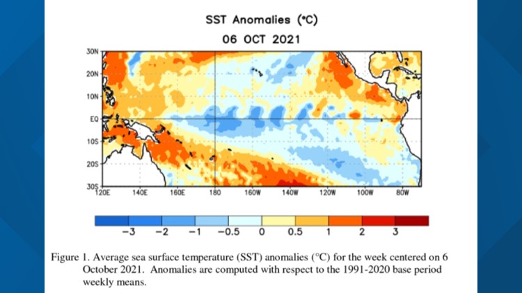
The determination of La Niña is based on the observation of below average sea surface temperatures present within a specific region in the Equatorial Pacific. Currently, these sea surface temperatures are valued within a range that is cooler than average. Technically -0.6 to 0.7 degrees Celsius for one index and -0.3 to 0.1 degrees Celsius for another.

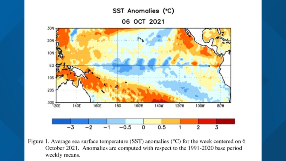
A newer observation though is the coupling of a correlating atmospheric circulation with these cooler than average sea surface temperatures. This just confirms the presence of a La Niña within the region.
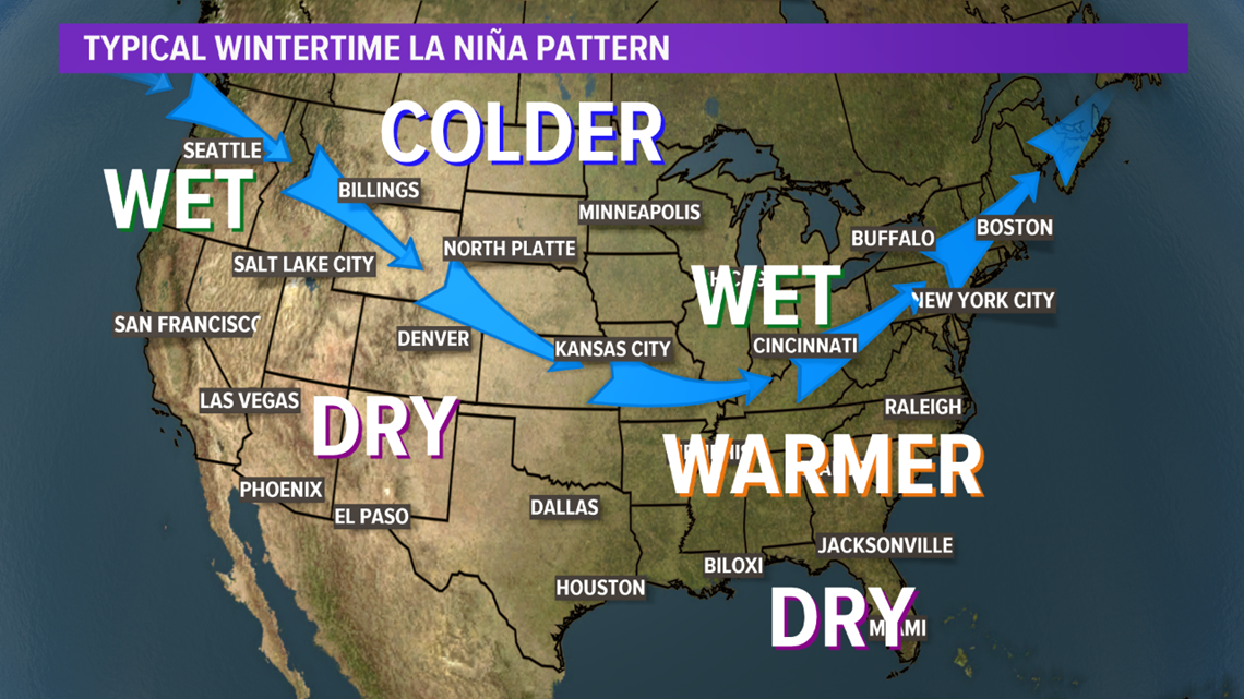
Also mentioned was the future impact of temperature and precipitation for this winter, but this is to be expected with any La Niña. Specifically for Western New York and much of the Northeast, the Climate Prediction Center is anticipating potentially warmer-than-average temperatures and above-average precipitation with a this La Niña pattern in place.
That being said, this is all based on the correlating jet stream pattern over the United States when a La Niña is present during the winter. In a La Niña wintertime pattern, the polar jet stream tends to dip farther south across the continental United States. The results of this jet stream pattern varies by location. Even so, it's never a guarantee for Buffalos' winter as the lakes have a heavy influence locally too.

And at the end of the day, all this means is that forecasters can confidently predict a La Niña will be present over the next few months and through the winter. The potential strength of this winter's La Niña is still to be seen, but it will at least be a weak to moderate La Niña.
This will be the second winter in a row with a La Niña as last year's moderate La Niña developed a little earlier in the fall and lasted all through spring too. Now there's not much to read into with having two La Niñas present for two winters in a row. Second La Niña years can vary as much as having no La Niña or even an El Niño.
El Niño Southern Oscillation (ENSO) is a large, naturally occurring ocean to atmosphere phenomenon located over the equatorial Pacific Ocean. It's positive phase is an El Niño and negative phase is a La Niña. And it's closely monitored year round as it can influence weather patterns across the Northern Hemisphere, especially during the fall, winter and even spring months.
RELATED: Storm Team 2 Weather Forecast