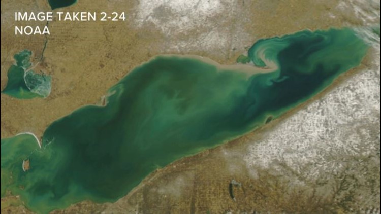
As of Monday, February 24, ice cover on Lake Erie was sitting at just 0.4 percent. Ice cover peaked at just 5.4 percent of Lake Erie’s entire surface a couple of weeks ago.
That wide-open lake surface leaves Western New York vulnerable to big lake effect storms and right on cue, that's exactly what's coming our way this week.
But what does an open lake mean once we actually get into the spring season?
We’re now just a few weeks away from astronomical spring. That means the sun angle, average temperature and amount of daylight are all increasing more rapidly. And all of that means that prime conditions for ice formation on Lake Erie are now behind us, likely making winter 2019-2020 one of, if not the season with the lowest maximum ice coverage on the lake.
A handful of other winters have ended with less than half of the lake shielded by ice, but an overwhelming 70% of the past 42 winters have seen ice coverage reach at least 90%. Shortly put, this winter has been exceptionally ice-free.
Springtime trends from previous record low ice cover winters certainly make a case for an early spring this year. In the Marches and Aprils that followed, none had an overall below-average temperature and some wound up being some of the warmest on record for the respective month. While there was some snow, it was nothing Earth-shattering and snow was often followed by more mild weather to melt it away.
As usual, there’s a strong scientific explanation to back up the correlation. When Lake Erie is a solid sheet of ice in late winter or early spring, more incoming energy from the sun has to go to melting the ice and less is available to warm the air, so the air around Buffalo stays colder later. When there’s little or no ice, there is more energy available to warm the air and temperatures rise faster as a result.
New episodes of Heather’s Weather Whys are posted to the WGRZ YouTube channel every Wednesday evening. You can also watch it on Thursdays at 5:30 on Channel 2 News.
If you have a weather question for Heather to answer, send it to her at heather.waldman@wgrz.com or connect with her on Facebook or Twitter.