
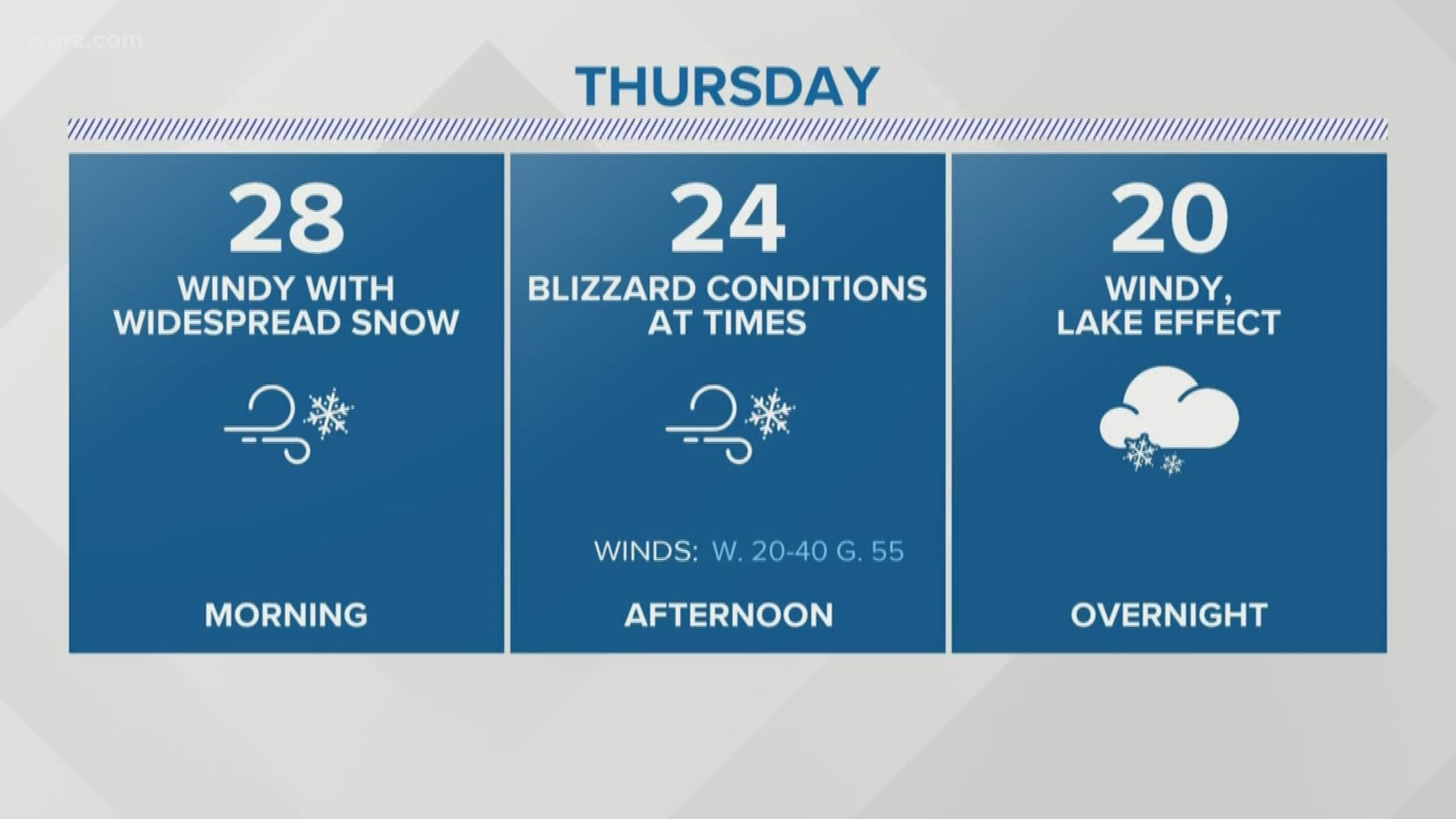
BUFFALO, N.Y. — Wednesday afternoon the Lake Effect Snow Warning was upgraded to a Blizzard Warning for the southern half of Western New York.
From Wednesday night through Friday afternoon, blizzard conditions are expected in southern Erie and Wyoming counties and the Southern Tier. The upgrade comes with the addition of wind gusts up to 55 mph and the likelihood of blowing and drifting snow.
CLOSING CENTRAL: Get the latest closings and cancellations here
A blizzard is an extreme weather condition where high winds and falling snow lead to reduced visibility from blowing snow. There are three specific traits that need to be met in the criteria for a blizzard:
1. Sustained or frequent wind gusts of 35 mph or greater
2. Falling or blowing snow that leads to visibility of less than a quarter mile
3. Above conditions lasting three hours or longer
In this winter storm, blizzard conditions are possible beginning Wednesday night and lasting through Friday afternoon. Any travel is not advised through the duration of the storm. Near white out conditions and snow covered roads are expected. Localized power outages could also occur due to the frequency of strong winds and the weight of accumulating snow.